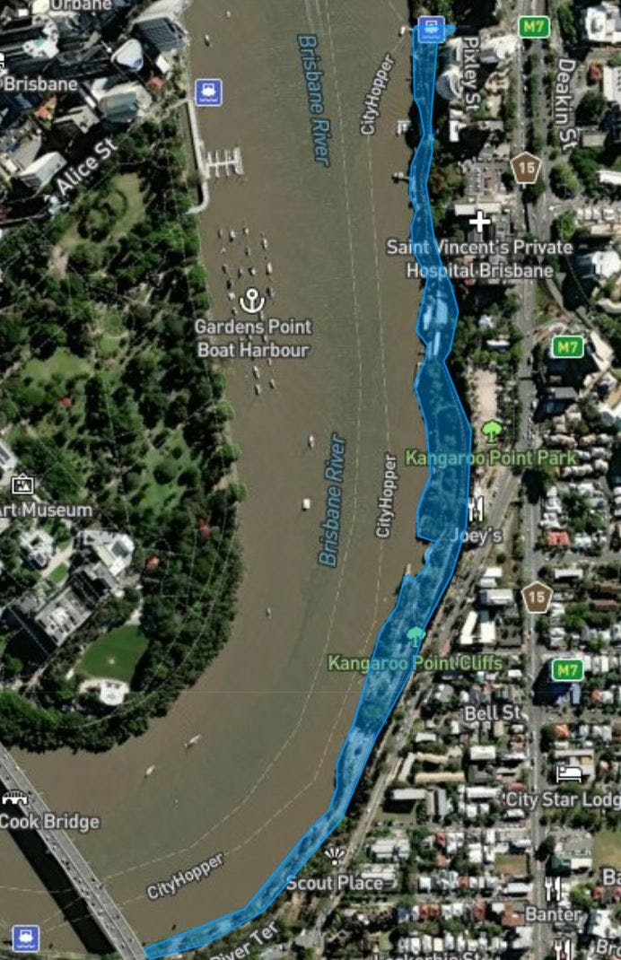
Kangaroo Point Bikeway – Captain Cook Bridge to Thornton Street
Consultation has concluded, thank you to everyone who has provided feedback.
Brisbane City Council is investigating potential options to improve the Kangaroo Point Bikeway, between Captain Cook Bridge and Thornton Street, Kangaroo Point.
We are seeking feedback to understand your experiences and how, why and when you travel along the bikeway, between Captain Cook Bridge and Thornton Street along with your aspirations for improving active travel in this focus area.
This review is part of our commitment to expand our city’s active travel network to deliver safe, convenient and connected paths and help to improve active transport options for Brisbane residents, visitors and commuters.
This study is a joint initiative of Brisbane City Council and the Queensland Government.
Note: In late 2022, Council undertook the Kangaroo Point active travel study which focused broadly on the area between Captain Burke Park, Kangaroo Point to Mowbray Park in East Brisbane. We are now turning our focus to investigations along the Kangaroo Point Bikeway, between Captain Cook Bridge and Thornton Street, Kangaroo Point, which is on the eastern side of the Kangaroo Point peninsula.
Have your say
Online consultation for this stage closed at 11:59pm on 08 October 2023.
Your feedback will be considered alongside our technical investigations and Council requirements to help shape options for potential future upgrades to Kangaroo Point bikeway between Captain Cook Bridge and Thornton Street.