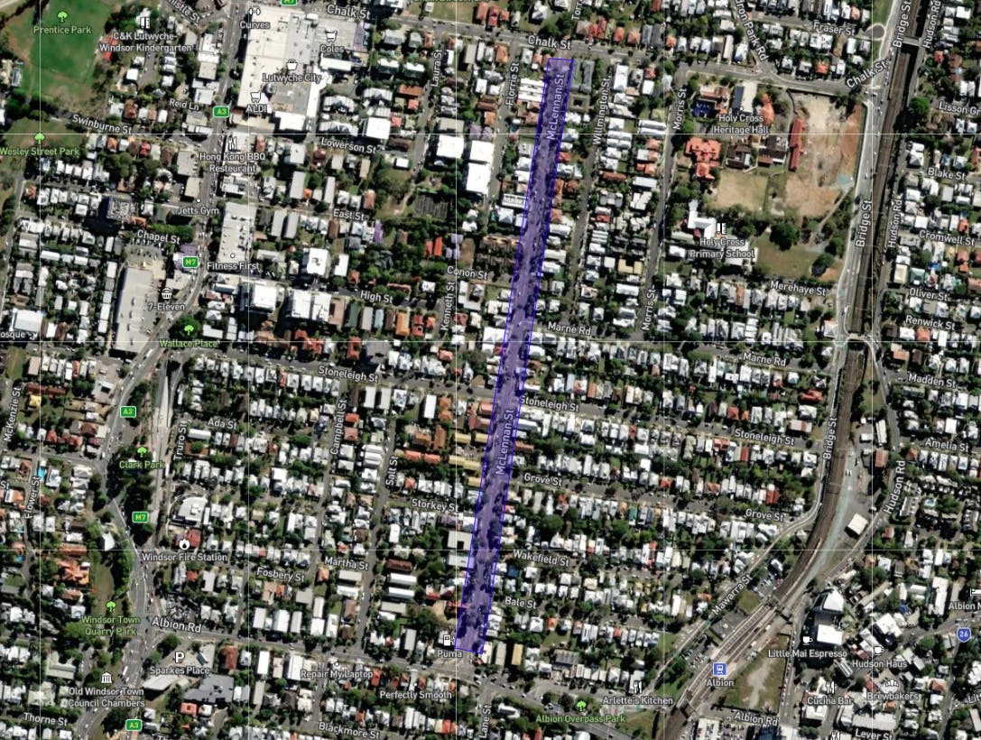
McLennan Street, Albion / Lutwyche / Wooloowin
Consultation has concluded.
Brisbane City Council is pleased to announce that funding has been allocated within Council’s 2022-23 Suburban Corridor Modernisation program to commence community consultation, planning and design of traffic and safety improvements along McLennan Street, Albion / Lutwyche / Wooloowin.
Following a review of ideas proposed by local residents in the past, we would like to seek your feedback on the following eight potential traffic and safety improvements for your consideration:-
- intersection improvements
- enhancement of:-
- pedestrian crossings
- footpaths
- traffic islands and
- landscaping
- long vehicle detour review
- speed awareness monitors and
- LED road signs.
You can view more information about each of these potential improvements by clicking on the "Suggestions" tab below.
Have your say
Online consultation on the design and planning of traffic and safety improvements along McLennan Street, Albion / Lutwyche / Wooloowin has now concluded. Thank you to everyone who has provided feedback.
Consultation has concluded.
-
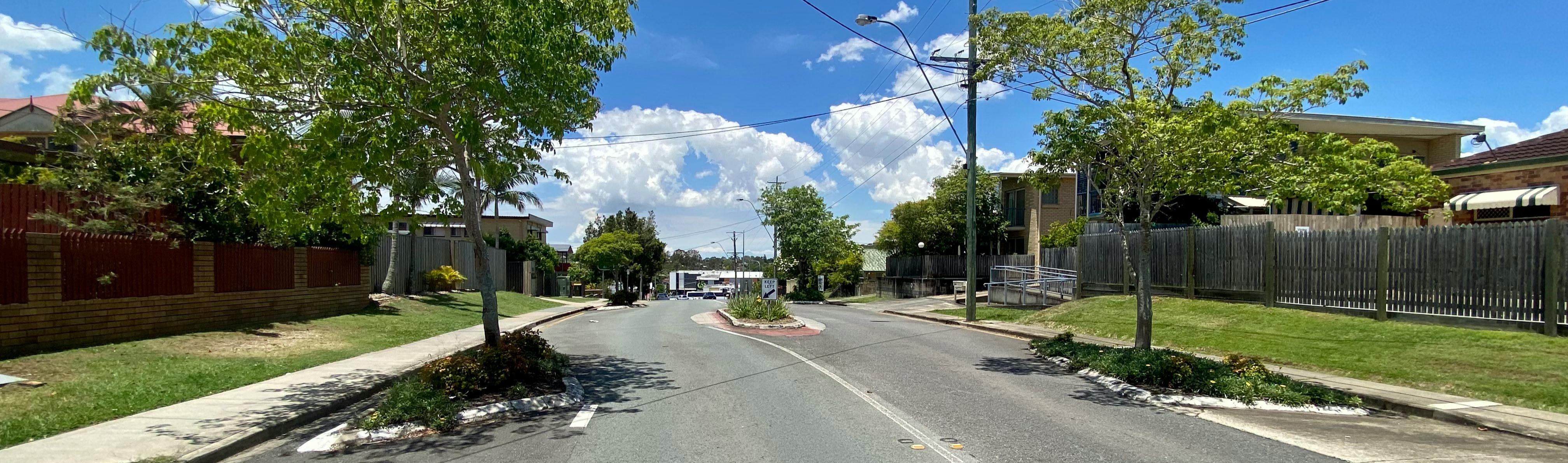
1. Intersection improvements
 Location
- Various locations along McLennan Street between Albion Road and Chalk Street
Traffic / Safety Improvements
- Installation of new splitter island with pedestrian slot and associated no stopping conditions at intersections to formalise driving paths, address corner cutting, improve pedestrian crossing access and safety, and enhance visibility for all road users.
- Kerb ramp realignment and associated no stopping conditions at intersections to improve pedestrian access and connectivity, and enhance visibility for all road users.
- Installation of Give Way / Stop control signs and line markings at intersections to improve driving paths, and enhance visibility for all road users.
Note
- No stopping conditions refer to yellow no stopping line markings or no stopping signs.
Consultation has concluded.
-
2. Pedestrian crossing enhancements
Location

- Various locations along McLennan Street
Traffic / Safety Improvements
- Review and enhance existing pedestrian crossing facilities on McLennan Street.
- Investigate additional pedestrian crossing facilities on McLennan Street to improve pedestrian access and safety.
To assist with planning, please indicate on the mapping activity the exact location of where you would prefer enhancements to existing pedestrian crossing facilities and/or additional pedestrian crossing facilities.
Consultation has concluded.
-
3. Installation of landscaped traffic islands
Location

- Various locations along McLennan Street
Traffic / Safety Improvements
- Investigate installation of landscaped traffic islands on McLennan Street at various locations. to improve on-road amenity.
Note
- Roundabouts/humpabouts on McLennan Street were considered however are not feasible due to road constraints.
- Speed platforms were considered however are not considered feasible due to potential safety and access impacts to local properties.
- This option will require the removal of on-street parking opportunities. The number of impacted on-street parking spaces would be determined in the next stages of design, should this idea receive community support.
Consultation has concluded.
-
4. Landscaping enhancements
Location

- Along the McLennan Street verge
Traffic / Safety Improvements
- Investigate landscaping opportunities along the McLennan Street verge.
Note
- Any landscaping locations need to consider sightlines, location of traffic control devices, location of public utilities above and below the verge and maintenance requirements.
To assist with planning, please indicate on the mapping activity the exact location of where you would prefer landscaping to be considered.
Consultation has concluded.
-
5. Footpath enhancements
Location

- Along both the eastern and western side of McLennan Street
Traffic / Safety Improvements
- Review footpath and verge along McLennan Street to support active transport use within and through the precinct.
To assist with planning, please indicate on the mapping activity the exact location of where you would prefer either a new footpath or footpath upgrade.
Consultation has concluded.
-
6. Long vehicle detour review
Location

- Bridge Street railway overpass and various locations along McLennan Street.
Traffic / Safety improvement
- Review and amend long vehicle detour signage for the Bridge Street railway overpass, which currently directs motorists to McLennan Street. The review would consider alternative routes encouraging the use of major roads such as Lutwyche Road and Sandgate Road, and the associated modification and relocation of existing detour signage for McLennan Street.
Note
- The feasibility of alternative detour routes will be confirmed during the next stages of design, should this idea receive support.
Consultation has concluded.
-
7. Speed Awareness Monitors (SAM)
Location

- Various locations along McLennan Street
Traffic / Safety Improvements
- The installation of SAM signs on McLennan Street to improve motorist awareness of the speed limit on McLennan Street.
Note
- SAM signs aim to change motorist behaviour and reduce speeding. They are not a permanent fixture and are installed for at least one month before being rotated between various locations within Council’s road network. If a location is supported, Council undertakes a site assessment to determine if the location is suitable for a SAM.
- More information about SAM signs is available on Council’s website.
To assist with planning, please indicate on the mapping activity the exact location of where you would prefer a SAM sign.Consultation has concluded.
-
8. LED road signs
To assist with planning, please indicate on the mapping activity the exact location of where you would prefer an LED road sign.Location

- Various locations along McLennan Street
Traffic / Safety Improvements
- The installation of LED (Light-emitting diode) road signs on McLennan Street to alert drivers of an upcoming intersection or traffic hazard, and to reduce their speed if they are travelling above the speed threshold that is pre-determined for that location.
Note
- LED road signs are vehicle activated signs meaning they are triggered by an approaching vehicle. The LEDs on the signs are inactive (unlit) by default and as a vehicle approaches the speed is detected by the sign’s radar. The speed threshold at which the sign is activated is not the speed limit for that location, rather, one that is pre-determined as a safe approach speed to the upcoming intersection or traffic hazard. If a location is supported, Council undertakes a site assessment to determine if the location is suitable for an LED road sign.
Consultation has concluded.